• Welcome to Tacoma3G.com, a free resource for 2016-2023 Toyota Tacoma owners!

    This website is the passion-project of a USMC veteran/mechanic, @Tyler. I created Tacoma3G.com to share my knowledge of this subject with others and to provide like-minded folks with a comfortable space to ask questions and create 'build threads' within our Tacoma Forums. Now, if the format of this website is confusing to navigate for you, or if you're interested in my full mission and T3G's history, check out the Help and About pages.

navigation

TacoHog

4️⃣ Gold
Joined
Feb 20, 2020
Messages
57
Reaction score
199
Location
Nocal Bay Area
2017 Pro DCSB Manual
Cement
Hi Guys - any suggestions on the best way to se up navigation? I'm considering a Garmin in reach and iPad ? any thoughts ?im not very tech savvy so im bring to figure out best configuration - can you download or link off road maps on the stock navigation? Any feedback would be greatly appreciated
 
I've got a Galaxy Tab S6 lite that I run GaiaGPS on and then usually also run Google maps on one of my phones. Sometimes I'll get stupid Entune running as well. I built a magnetic setup for mounting everything.
 
Gaia GPS on a phone or tablet is pretty sweet, it'll also run on CarPlay if your truck is able.
And, always carry back up paper maps for your location.
 
Yep. Not too hard. Gaia is great, lots of online support, and tons of maps. You'll like it.
 
Gaia works Good. Personally I only use Gaia and google maps pro to plan Routes and possible camp sites. For in rig navigation I use the gear in overlander and also the In reach 66i. I have the iPad with Gaia with me but rarely use it enroute.
 
I have an IPad and run Gaia and OnX on it. You need a cellular capable IPad for the navigation apps to work. You don’t need to actually have a cellular service plan for the IPad but only cellular capable IPads have a GPS unit. With the Gaia app you can record your trips and share the GPS data with others, you can also download other people’s trips into your app and follow the same route they took. You can download hi res maps to Gaia and OnX so you have them even outside of cellular/WiFi service.
 
Off road I use Gaia and download the areas where I am going, that way I have the maps. For gps, I use a “BadElf” that I pair with my phone or iPad. This summer I used Gaia, the BadElf and CarPlay to show the maps/route on my Radio screen. Just had to put the phone on airplane mode, hook up Bluetooth and the mapping working using CarPlay. The big thing is to download the area you want to go to, so if you get off cell service you have the map. I have used this on my trips to Tuktoyaktuk, loaded NMBDR, some Gila trails and more and just started loading the Pony Express Trail for next fall. I am just starting to look at onX Offraod.
Still looking at different mounting points for my iPad, as CarPlay doesn’t give enough information on the Gaia app as I want.
For trips on the road, I load my destination into the Toyota maps and Google or Apple Maps and see which gives me the route I want. Sometimes the Toyota maps are really screwed up and will take a route that adds 1-2 hours or more than Google or Apple Maps.

Bad Elf Pro Bad Elf GPS Pro
 
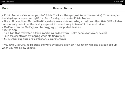
Gaia just did an update, now has a new “Map Overlay” - “Public Tracks”. If I understand this correctly, if you put your recorded tracks to public it should be able to be seen by others.
I.E: I run the pony express and record it, then anyone should be able to follow my tracks.
 

Attachments

  • 318CCDA5-5C1B-44F8-A4F0-CA924A27EFEF.png
    318CCDA5-5C1B-44F8-A4F0-CA924A27EFEF.png
    665.2 KB · Views: 102
Maybe one of you guys on this thread can help me. I've been trying to use Gaia to find good offroad routes around norcal and nevada. The one thing that bugs me a bit about Gaia, is I can't often distinguish if a public track/route was hiked, biked or driven. It would be cool to start a thread with folks here who've shared tracks.
 
I have been talking with Toyota Canada to be able to type GPS cooridinates instead of address.
This would solve my problem as I tried finding the position on google maps and a crossroad Rd 84N and 5E and it took me right to where I wanted to be event though there where no roads on the map but the software found the location
 
This is a question for USA vehicles. Can you type in GPS locations instead of address?
On the Tacoma 2021 we have Scout gps I believe and we cannot search by GPS location only address
 
Last edited:
I don't think you can in the US rigs either.

I just use the truck GPS as a backup and use GaiaGPS or Google Maps for everything

EDIT: Oh, it looks like I said that exact same thing on Dec 29, 2020
 
Last edited:
Maybe one of you guys on this thread can help me. I've been trying to use Gaia to find good offroad routes around norcal and nevada. The one thing that bugs me a bit about Gaia, is I can't often distinguish if a public track/route was hiked, biked or driven. It would be cool to start a thread with folks here who've shared tracks.
Not sure if this will help you.
In the Gaia app, you can hit the search button and then next to the “popular nearby” hit the filter button. Let’s call it the second line down, “activity” and you should be able to selected off-roading and hit apply and then routes around you will display in the left column.
 
The fun part about finding trails on Gaia, there often isnt much info. Ive gotten in the habit of cross referencing tracks on trailsoffroad.com or alltrails.com. Got in over my head a couple times. You can run an ipad without cellular as long as you pair it to your Garmin. I keep low res maps on there of Colorado and Utah and then download higher res ones for specific areas I'm visiting. You can also import tracks off those previously mention websites and save them in Gaia.
 
GaiaGPS recently updated their in-house topos to be vector based. So now I have all of California with land ownership and MVUM on top of their topos downloaded to my phone. Very useful. I'll probably get a cheap tablet for navigation since I have Entune 2.0, though.
 
Yes I use a spare iPhone with no chip (no cell service) and use backup maps from google which gives all areas in Province
 
I use spare iPhone with no cell service with offline saved google maps (CarPlay) if I go out of cell service.
 
A question, so how does that know where you are? Do you hook it up to a GPS device?
 
The reply from Toyota Canada was they have abandoned anything to be done with GPS
Have not even got a update on the maps or reply from Dealer were I purchased truck.
So much for supporting their product!!!!
 
Back
Top